Showing posts with label map. Show all posts

Crowdsourced Continents: The World

Friday, October 30, 2015

Crowdsourced Continents: The World
For the past few years, I've been going to events in London asking people to draw maps of continents.

I went to a Latin American festival, Canada Day and USA Independence Day events, a UK / Australia cricket match, a European folk music festival, an African Craft Fair and a variety of Asian events.

At each, I asked people at the event to draw a map of that event's continent. Some people came from the continent, some from elsewhere.

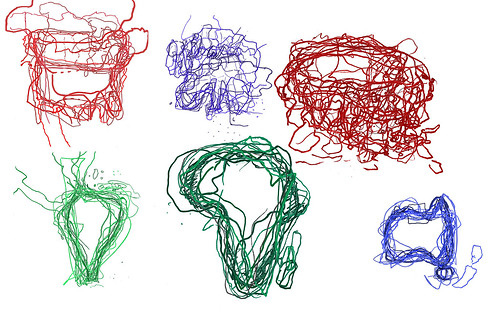
I then took all these maps and laid them on top of each other to create a jumbly mind-memory-map of these continents. And here are all those maps, as the world.

Some were clear - Africa, Australia, South America - and some much less so - Europe and Asia.

In all, we can see that maps are made by drawing, constructs in the moment, made from memory which is patchy and personal, familiar and fascinating.

I've had really interesting conversations with the 87 people who drew these maps, and hopefully, you enjoy them too.
Crowdsourced Continents: Asia

Thursday, October 22, 2015

Since 2009, I have been (on-and-off) asking people to draw maps of continents which I then overlay on each other.

I've asked people to draw South America, Australia, North America, Europe and Africa.

But I've waited a long while to 'do' Asia. Mainly as I didn't know how to approach Asia.

I had previously asked people at a SouthEast Asian festival to draw some maps, could I follow that idea with more regions. Should I divide Asia into regions and, if so, which regions?

The answer had been staring me in the face rather obviously: ask people to draw 'Asia' - a seemingly simple but complex challenge.

In August and September, I went to a variety of events where I asked people to draw Asia:

I met people at these events who I asked to draw Asia. And I also asked a few friends who have connections to Asia. So here is the result.


Sketched Asia
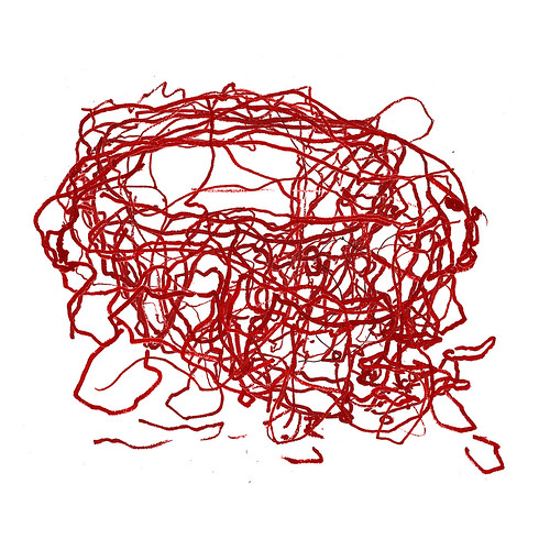
It's quite a tangle of lines, shapes, places. Asia seemed to be a difficult concept for the people I asked: where does it start and end? where does it include? 

Many people only drew their own country. 

Thanks to: Phuong, Alex, Darren, Aaron, Kris, Koa, Ekta, Hang Catie, Shuk Kwan, Raj, Suraj, Mohammad, Tina, Jeff, Sultan, Keejung, Niie, Dana, Chris and Taemin for humouring me and drawing a map.

Here are their maps individually.


And that is my last crowdsourced continent map: in my next blog, I'll show all the continents together.

Europe in USA

Wednesday, July 16, 2014

For many years, I've been interested in the way towns, cities, villages and more in the USA are named (I wrote about in 2010).

Reading the article which inspired that blog, I realised that nearly all of Europe was accounted for in American placenames.

So I set about making a map of some European place-names in the USA.


Sadly, there isn't a place for every country in Europe, though sometimes there are more than one, e.g. Norway, Kansas, Norway, Iowa and Norway, Maine, so I chose the place which sat best on the map.

In some cases, a country name is not accounted for, but the capital city is e.g Vienna, Georgia or Sofia, New Mexico.

And occasionally, you really can't be sure that the European placename is the inspiration - e.g. Turkey, North Carolina or San Marino, California

I'm fascinated by the breadth and number of places with names inspired by Europe. I suppose the next step is to start visiting them!

Africa, sketch maps

Monday, June 02, 2014

I've resumed collecting crowd-sourced* 'multi-maps'.

*when I first started asking people to draw maps, crowd-sourcing wasn't a popular term but it is now and works well.

Previously, I've collected maps of North America, South America, AustraliaSouth East Asia and Europe.

This time, I looked for maps of Africa.

I went to an African Market in Spitalfields to ask stallholders, shoppers and spectators to draw Africa.

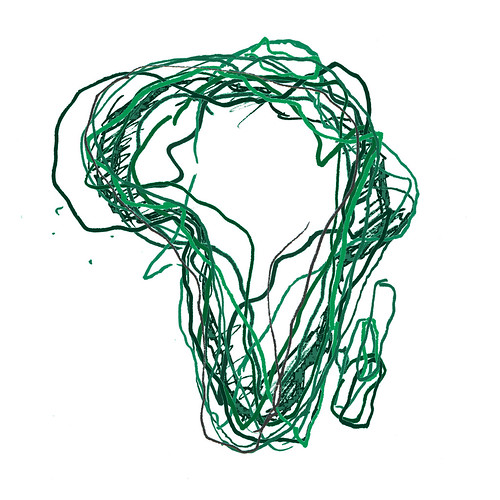
I asked twelve people to draw Africa. I've overlaid these maps on top of each other. This is the result.

Africa, sketched

Map Cards

Wednesday, April 30, 2014


I've been making more map cards. I'll be selling them at a craft fair at Balham Bowls Club (it's a bar!) on Sunday 11 May. See you there, maybe?

I started with Christmas trees made from maps on white paper.


Next, I moved on to hearts on white paper - ideal for Valentine's Day, or any day to show your love of locations.

Now, the cards come in glorious technicolour with lots of different colours and shades.


And I've been experimenting with different shapes too.


Europe Re-Drawn

Monday, September 16, 2013

About 8 years ago, I started asking people to draw maps of the world. It was a fun project, and over the course of 6 years, I collected the world drawn by 80 people - the world in 80 ways.

Moldova, drawn by Andrei


During this, I also realised I enjoyed the idea of people drawing their own country - so I set about finding Europeans* to draw their country. And, today, I have finally finished!

The first map I uploaded was on 6 April 2005 - the Netherlands by Rolf. The last - just today, 16 September 2013 - was Bosnia & Herzegovina by Ahmet.

Over the past 8 years, I've collected maps from:


You can see the story behind each map here.

And I've enjoyed it all, meeting new people, talking to them and learning more about the huge variety and diversity in Europe.

And now all that's left to be said is a very, very large thank you to all those who took the time to draw me maps.

Ahmet's map of Bosnia & Herzegovina

This weekend, Ahmet drew a map of Bosnia and Herzegovina for me.

Moldova, drawn by Andrei

I met Ahmet at The Abbey Centre, a wonderful community centre where a Bosnian school takes place on Saturdays.

Ahmet drew his map showing the main cities, including Bihać where he comes from.

Ahmet told me that, in Bosnia, he was a professional. But he arrived in London not speaking English, and has since dedicated his time to learning English while working as a post man - something he likened to the Japanese Kaizen philosophy.

I'm delighted that Ahmet has drawn his map for me, particularly as it's my last map and I've now collected a map for every European country.

Andrei's map of Moldova

Tuesday, September 10, 2013

I've been searching for a long time for someone from Moldova to draw me a map.

Finally, on Friday, I found Andrei. He drew this great map of Moldova.

Moldova, drawn by Andrei

I met Andrei celebrating with friends outside Wembley stadium before the England -v- Moldova match.

As he drew, Andrei told me Moldova looked like a bunch of grapes and he drew the main cities in grape-like circles.

When he finished, he explained to his friends what he had been doing. I said I had been looking for a Moldovan for a long time.

"But there are loads of Moldovans in London!" said his friend.

I beg to differ; it's taken many tries to find them....

I went to Casa Romanescu, a restaurant in deepest, northernest Edmonton. I'd read that some of the staff there were from Moldova, so it was worth paying a visit. One my first and second attempt, everything was locked up. Finally, third time lucky, I was able to visit.

From outside all looked quiet, but inside a live trio blared out traditional Romanian music. After eating, I asked the waiter if there was anyone from Moldova here. "No," he said.

But then Natalia from Moldova came over to talk to me. And so it turns put there are two Moldovas - the Republic and the region of Romania.

Later, Juliana - a level 3 beautician also from Moldova (region of Romania) - chatted to me. She had a friend from Moldova (republic). She took my telephone number and then never got in touch.

Then I discovered the Moldova UK forum where a chap called Eduard said he would draw a map. I emailed, but no reply.

So after many months of Moldovan minutiae, I have finally collected a map. My next and final person / map to find must come from Bosnia and Herzegovina. (And I've already got an idea...)

Tasos' map of Cyprus

Thursday, January 24, 2013

While I was in Budapest a few months ago, I started chatting to a guy who turned out to be from Cyprus.

I quickly asked Tasos to draw his map of Cyprus.

Cyprus, drawn by Tasos
And so now I have collected maps of all but two European countries: Bosnia & Herzegovina and Moldova.

Eva's map of Andorra, Charlotte's map of Monaco

Monday, July 09, 2012

In my quest for maps of micronations, I took a trip recently, travelling first to Andorra and onwards to Monaco.


In both places, lovely people working in the tourist offices drew maps for me. I'm nervous of tourist offices, as whenever I've asked their staff  to draw maps, they hand me one of their many printed maps.

Eva in Andorra was about to do this, but I convinved her that I wanted a hand-drawn map. "OK", she said, and set about producing the most detailed map I've got. It's in four colours and has a legend.

I explained in fledgling Spanish why I was asking for a drawn map. "It's very interesting", said Eva looking proud of her map. And well she should.

Andorra, drawn by Eva

Later in the trip, in Monaco's tourist office, Charlotte drew another wonderfully detailed map of Monaco. At one point, I wondered nervously if she was just drawing Monte Carlo and not Monaco. Then I realised it's pretty much the same thing.

Charlotte seemed pleased with her map too. "We've never had anyone ask us for this before," said her colleague.

Monaco, drawn by Charlotte 

 So these two very detailed maps come from two very small states - and it seems very appropriate for my project to give them as much space as the whole map of larger countries like Russia or Germany.

Steve's map of Malta

Saturday, August 06, 2011

About six weeks ago, I put some ads up in art shop noticeboards hoping to find people to draw maps. And happily a reply from Steve from Malta popped up.

I met him the other day and he drew this lovely map of Malta.

Malta, drawn by Steve


"Malta looks a bit like a fish," Steve told me. I'd never noticed it before, but Steve - who is an illustrator and designer - obviously has a good eye for detail. He has also put in the original Maltese names of the islands Comino and Gozo.

We spent a nice couple of hours talking design, London, accents, geography, Scotland, African fabric, and all sorts of other interesting things.

He has a great website here: http://www.leftylemur.com with some excellently interesting design projects.


So now the idea of a new map of Europe is taking shape - I've only eight more maps to collect, with 'leads' for several of them. But the tiniest are the trickiest: Andorra, San Marino, Monaco! I may have to take a trip.

EuroGlobe, a map of Europe by Europeans

Sketching Europe & Southeast Asia

Wednesday, July 13, 2011

I collected these maps two years ago, but never put them online.

The first was collected at a Thailand festival in Greenwich Park (where I saw the winner of Thailand's Got Talent performing). 15 people drew their maps of Southeast Asia, so thanks to Kris, Rose, Kirsty, Emma-Louise, Hita, Jem and Catherine from the UK, Rose, Yuttakorn, Annie and Chookiat from Thailand, Chris and Denny from New Zealand, Pepper from the Philippines and Alex from Italy.

Sketched Southeast Asia

Photobucket

Sometime later, I went to the New European Village festival at Southbank to ask for maps of Europe. Thanks to the 11 people who drew a map: Joe, Zimbab and Janine from Germany, OQ a 'secret Turk', Sophie and Celine from France, Poppy from Greece, Baz from Belgium, JK from England, Claudia and Luisa from Colombia.

Sketched Europe

Photobucket


The last few maps have not been as precise as the previous two. Maybe Australia and Latin America are more defined places than Europe and Southeast Asia. Certainly, their shapes are easier to know.

This makes me wonder how to collect the remaining continents. I'm not so worried about Africa, but Asia's more unusual. Do I divide it into regions?

My first thoughts are to have Middle East, India, and China, but it's not an easy division. Where to put Russia, and the big wide middle-ground?


Sketching North America

Monday, July 04, 2011

It's been a while (2 years) since I went collecting continent maps at London festivals. I've decided I want to collect the world, so this weekend I went in search of North America.

Eleven people drew maps, and here they are all over-laid.

NorthAmerica


On Friday, I went to Trafalgar Square for Canada Day celebrations. There was hockey, mounties, beer and curly fries. It was all very good fun, with people wearing red and maple leaves all over. The 6 people who drew maps for me were fun and friendly.

On Sunday, I searched out 4th of July celebrations. The first event I went to (in Portman Square) was a bit too private, so instead I then went to King Edward Memorial Park where I expected to find a big American picnic.

The turn-out was in fact smaller, but 5 people obliged me. One man had a flag on his hat. Swell!

So, thanks to Alisha, Jen, Jo and Lauren from Canada, Amy, Jessica, Jon and Tim from the USA, Christina and Grem who are English, and Izzy who is English (and Austrian too). Here are their maps individually:

Photobucket

Irina draws Bulgaria

Wednesday, June 29, 2011

The end of me asking Europeans to 'draw-your-country' is inching ever closer. Only 15 countries remain and, although they're elusive, I'm as keen as ever.

Excitingly, at a party this weekend, I met two Bulgarians, Elena and Irina. I asked Irina, an architect, to draw Bulgaria.

Bulgaria, by Irina


Irina, who has lived in London for thirteen years, thought it could be difficult to draw as the borders had often changed.


By coincidence, she had been having a conversation about maps with a map-maker just before I asked her to draw. This, she said, was probably the first map of Bulgaria she's drawn since school. Amazing!

----

So now, I've 15 countries left to find, and I'm getting a bit more proactive. So if you know someone from any of the these places, let me know: Albania, Andorra, Bosnia-Herzegovina, Cyprus, Czech Republic , Latvia, Luxembourg, Macedonia, Malta, Moldova, Monaco, Montenegro, San Marino, Slovakia, Turkey.

Norway by Isaak, Belarus by Natalia

Friday, May 27, 2011

I've had a map of Norway in my 'drawing Europe's countries' project for a few years. But I'm not quite sure that it's Norway (it could be an upside down Finland...). This is it:

Norway, by anonymous?


So, in Norway, I decided to ask someone to draw another map. Isak - who works in a theatre - drew a map of Norway - very accurately - pointing out Tromso, Kirkenes and Oslo, the place where all the money is.

Norway, drawn by Isak

Recently, out of the blue, through the postcrossing site, I received a postcard from Natalia in Minsk on which she'd drawn a map of Belarus.

This was fantastic. I'm not sure whether I'd ever meet someone from Belarus so I'm very pleased that Natalia sent me her map, which shows Belarus' biggest cities and towns.

Belarus, drawn by Natalia

Adrian, USA

Friday, November 05, 2010

Adrian, USA

Whilst reading the article on the nomenclature of American towns, I got to wondering about places with my name. It turns out there's quite a few Adrians in America, stretching all the way from New York to Washington. 

The majority of American Adrians are quite small, with no more than a couple of hundred people in each. Some are named after settlers, with one, Adrian, Oregon, named after another Adrian: Adrian, Illinois.

Adrian Minesota, one of the larger Adrians, with more than a thousand inhabitants, was named after the mother of the local railway's directors. She was called Mrs Adrian Iselin, and he was Adrian C. Iselin. So really he named it after himself. The locals, apparently, prefer to believe the town was named after St Adrian.

Adrian, Michigan is perhaps the most exciting of all, with a plentiful 21,000 inhabitants. During the late 19th century and early 20th century, it was known as the "fence capital of the world," as it was where the first successful wire fence was invented. Fancy that. 

Map pictograms: the world as washing

Thursday, September 23, 2010

How to advertise washing machines to me: add a world map made from clothes. I found this lovely image in a Latvian magazine.


Map pictograms: Georgia

Tuesday, September 07, 2010

It's probably fair to say we don't see many maps of Georgia printed in the UK. So I was intrigued to see these maps in The Economist magazine - advertising Georgia as a business opportunity. Whether you agree with the attempts to westernise Georgia or not, the maps and landscapes are stunning.


Map pictograms: Ireland unwound

Wednesday, July 21, 2010

Two tourism ads with maps showing Ireland and Britain in cord-form. The latter suggests that Britain's all tangled up (nice unwitting Girls Aloud reference) while Ireland's all relaxed.


Hand-drawn maps of Poland by Renata and Romania by Mario

Tuesday, April 20, 2010

I haven't asked people to draw maps for me for quite some time, but my project to re-draw a map of Europe is still definitely going.

I met Mario from Romania at a party a few weeks ago, and asked him to draw this map. I also told him that his country may win Eurovision this year. He was quite excited about this.

Romania, by Mario

Several months ago, I asked my Austrian boyfriend to ask his Polish cousins to draw a map of Poland - so here's Renata's map of Poland.

Poland, by Renata

I'm now more than half-way through my quest to collect a map for every country in Europe - but I still have great swathes of central and Eastern Europe to find.

EuroGlobe, a map of Europe by Europeans