Showing posts with label EuroRevision. Show all posts

Europe Re-Drawn

Monday, September 16, 2013

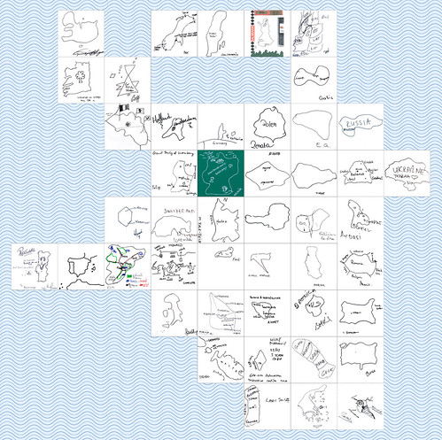
About 8 years ago, I started asking people to draw maps of the world. It was a fun project, and over the course of 6 years, I collected the world drawn by 80 people - the world in 80 ways.
Moldova, drawn by Andrei


During this, I also realised I enjoyed the idea of people drawing their own country - so I set about finding Europeans* to draw their country. And, today, I have finally finished!

The first map I uploaded was on 6 April 2005 - the Netherlands by Rolf. The last - just today, 16 September 2013 - was Bosnia & Herzegovina by Ahmet.

Over the past 8 years, I've collected maps from:


You can see the story behind each map here.

And I've enjoyed it all, meeting new people, talking to them and learning more about the huge variety and diversity in Europe.

And now all that's left to be said is a very, very large thank you to all those who took the time to draw me maps.
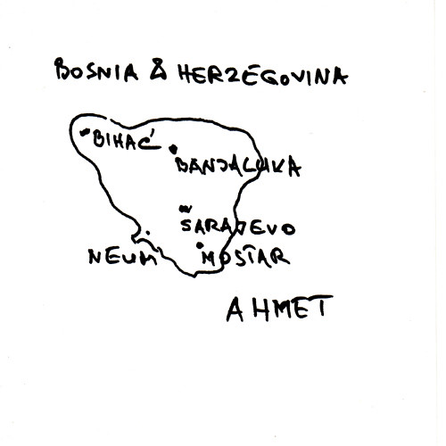
Ahmet's map of Bosnia & Herzegovina

This weekend, Ahmet drew a map of Bosnia and Herzegovina for me.

Moldova, drawn by Andrei

I met Ahmet at The Abbey Centre, a wonderful community centre where a Bosnian school takes place on Saturdays.

Ahmet drew his map showing the main cities, including Bihać where he comes from.

Ahmet told me that, in Bosnia, he was a professional. But he arrived in London not speaking English, and has since dedicated his time to learning English while working as a post man - something he likened to the Japanese Kaizen philosophy.

I'm delighted that Ahmet has drawn his map for me, particularly as it's my last map and I've now collected a map for every European country.

Andrei's map of Moldova

Tuesday, September 10, 2013

I've been searching for a long time for someone from Moldova to draw me a map.

Finally, on Friday, I found Andrei. He drew this great map of Moldova.

Moldova, drawn by Andrei

I met Andrei celebrating with friends outside Wembley stadium before the England -v- Moldova match.

As he drew, Andrei told me Moldova looked like a bunch of grapes and he drew the main cities in grape-like circles.

When he finished, he explained to his friends what he had been doing. I said I had been looking for a Moldovan for a long time.

"But there are loads of Moldovans in London!" said his friend.

I beg to differ; it's taken many tries to find them....

I went to Casa Romanescu, a restaurant in deepest, northernest Edmonton. I'd read that some of the staff there were from Moldova, so it was worth paying a visit. One my first and second attempt, everything was locked up. Finally, third time lucky, I was able to visit.

From outside all looked quiet, but inside a live trio blared out traditional Romanian music. After eating, I asked the waiter if there was anyone from Moldova here. "No," he said.

But then Natalia from Moldova came over to talk to me. And so it turns put there are two Moldovas - the Republic and the region of Romania.

Later, Juliana - a level 3 beautician also from Moldova (region of Romania) - chatted to me. She had a friend from Moldova (republic). She took my telephone number and then never got in touch.

Then I discovered the Moldova UK forum where a chap called Eduard said he would draw a map. I emailed, but no reply.

So after many months of Moldovan minutiae, I have finally collected a map. My next and final person / map to find must come from Bosnia and Herzegovina. (And I've already got an idea...)

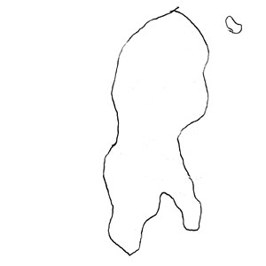
Tasos' map of Cyprus

Thursday, January 24, 2013

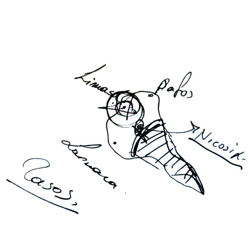
While I was in Budapest a few months ago, I started chatting to a guy who turned out to be from Cyprus.

I quickly asked Tasos to draw his map of Cyprus.

Cyprus, drawn by Tasos
And so now I have collected maps of all but two European countries: Bosnia & Herzegovina and Moldova.

Eva's map of Andorra, Charlotte's map of Monaco

Monday, July 09, 2012

In my quest for maps of micronations, I took a trip recently, travelling first to Andorra and onwards to Monaco.


In both places, lovely people working in the tourist offices drew maps for me. I'm nervous of tourist offices, as whenever I've asked their staff  to draw maps, they hand me one of their many printed maps.

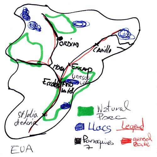
Eva in Andorra was about to do this, but I convinved her that I wanted a hand-drawn map. "OK", she said, and set about producing the most detailed map I've got. It's in four colours and has a legend.

I explained in fledgling Spanish why I was asking for a drawn map. "It's very interesting", said Eva looking proud of her map. And well she should.

Andorra, drawn by Eva

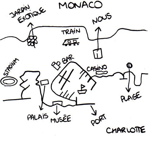
Later in the trip, in Monaco's tourist office, Charlotte drew another wonderfully detailed map of Monaco. At one point, I wondered nervously if she was just drawing Monte Carlo and not Monaco. Then I realised it's pretty much the same thing.

Charlotte seemed pleased with her map too. "We've never had anyone ask us for this before," said her colleague.

Monaco, drawn by Charlotte 

 So these two very detailed maps come from two very small states - and it seems very appropriate for my project to give them as much space as the whole map of larger countries like Russia or Germany.

Myriam's map of San Marino

Wednesday, April 18, 2012

I visited San Marino three years ago.

On my way there, I left my phone on the bus. Myriam, who worked at my hotel very kindly drove me to the bus garage to get my phone back. I spent some time talking to her, she was a very nice person.

During all this, for some reason, I didn't ask her to draw a map of San Marino. Maybe I just forgot, or felt a bit foolish.

I went back to San Marino this week, and found Myriam still working in the hotel.

She remembered me from three years ago, and then drew this wonderfully detailed map of San Marino.

San Marino, drawn by Myriam

Thanks Myriam!


So now my collection of maps of European countries is nearly done - only Andorra, Bosnia, Cyprus, Moldova and Monaco are left. I'm determined to finish the collection this year - here's hoping.

EuroGlobe, a map of Europe by Europeans


Juraj's map of Slovakia

Monday, October 10, 2011

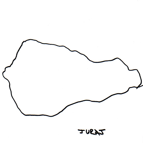
Even though it took me some time, I didn't have to look far to find someone to draw a map of Slovakia.


Juraj, who I work with, was happy to draw this great map of Slovakia. 


Slovakia, drawn by Juraj


This takes my tally to 41 with only six countries to go: Monaco, San Marino, Andorra, Bosnia, Cyprus and Moldova.

Philipp's map of Luxembourg

Wednesday, September 14, 2011

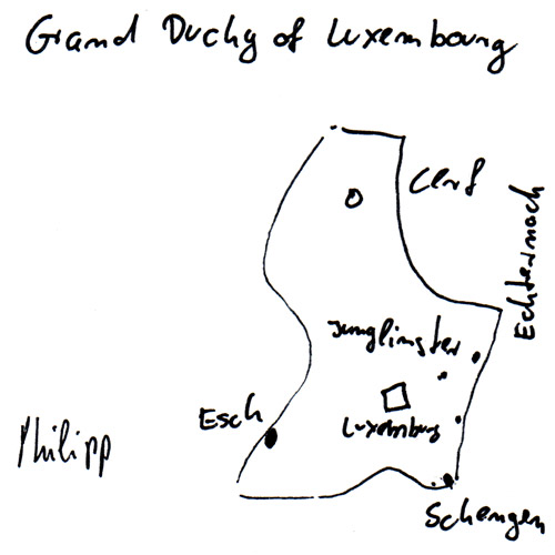
There aren't many Luxembourgers in the world, but some of those in London meet at a pub every month. I went along, hoping to find someone to draw me a map.

The friendly gentlemen I found there happily helped, taking it in turns to draw the perfect map.

Luxembourg, drawn by Philipp

Luxembourg, they said, was shaped like a shoe on its side.

Phillippe's map shows some of Luxembourg's cities and towns including the small village Schengen which gives its name to Europe's open border visa arrangement. So three cheers for Luxembourg, the powerfully petit Grand Duchy.

Steve's map of Malta

Saturday, August 06, 2011

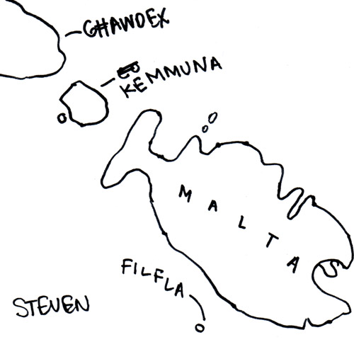
About six weeks ago, I put some ads up in art shop noticeboards hoping to find people to draw maps. And happily a reply from Steve from Malta popped up.

I met him the other day and he drew this lovely map of Malta.

Malta, drawn by Steve


"Malta looks a bit like a fish," Steve told me. I'd never noticed it before, but Steve - who is an illustrator and designer - obviously has a good eye for detail. He has also put in the original Maltese names of the islands Comino and Gozo.

We spent a nice couple of hours talking design, London, accents, geography, Scotland, African fabric, and all sorts of other interesting things.

He has a great website here: http://www.leftylemur.com with some excellently interesting design projects.


So now the idea of a new map of Europe is taking shape - I've only eight more maps to collect, with 'leads' for several of them. But the tiniest are the trickiest: Andorra, San Marino, Monaco! I may have to take a trip.

EuroGlobe, a map of Europe by Europeans

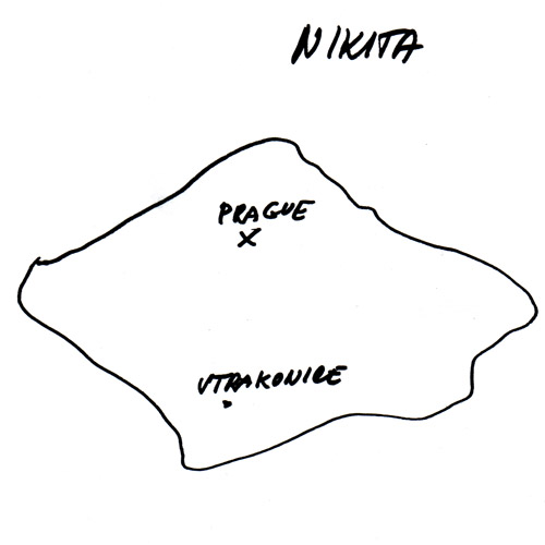
Baki's Kosovo map; Ladi's Albania map; Nikita's Czech map

Wednesday, August 03, 2011

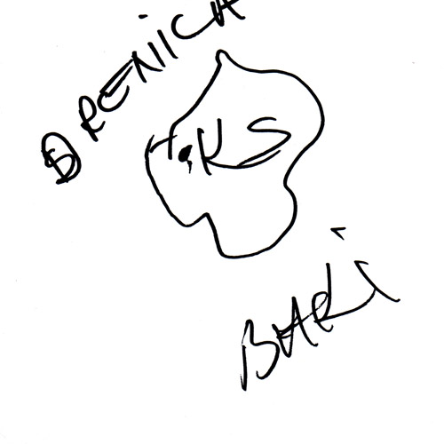
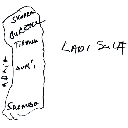
I took a trip to Kilburn to the Queens Arms pub, which has recently become a centre for Kosovars and Albanians in London.

There, I met Baki and Ladi who drew their maps of Kosovo and Albania for me.

Kosovo, drawn by Baki

Albania, drawn by Ladi

(Things were a bit complicated: all these guys were Albanian, some of them from Kosovo. So I asked Baki from Kosovo (who is Albanian) to draw Kosovo, and Ladi who is Albanian to draw Albania...)

Both were part of a group celebrating a friends' birthday. I stayed with them a while and had a wide-ranging conversation about tourism in Albania, Serbian women, mad people in Ireland who support Nazis, the NHS and how the name Adrian is very international.

Later, I realised that one of the bar staff came from Czech Republic, so asked her to draw a map for me. Nikita's response was, "are you really serious?" but she drew this great map anyway.

Czech Republic, drawn by Nikita

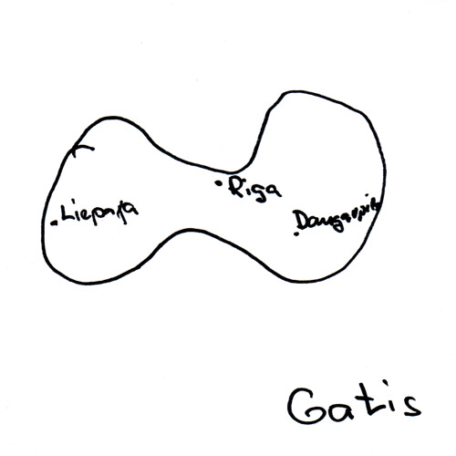
Gaļis' map of Latvia

Monday, August 01, 2011

In search of people to draw maps, I recently went to 72 Queensborough Terrace, a Latvian guesthouse and bar. There I met Gaļis who drew this map.

Latvia, drawn by Gaļis

Gaļis was born in Liepāja where there are beautiful beaches. He has been living in London for 5 months, and wanted to practise his English, so we chatted for a while.

"You are most welcoming to stay," he said, encouraging me to spend a very fun and random evening, which included the following:

  • A man who was considering visiting friends in Kyrgyzstan

  • A man conducting anthropological experiments. I took part. He asked me to stare into my eyes in a mirror for 10 minutes. Weird.

  • A strawberry cider called Fizz!

  • Latvian versions of Cabaret and Those Were the Days with satirical political lyrics.

  • A woman sat next to me. She told me that so many times others had tried to "con-queer Latvia". But she didn't let it bother her.

  • I spent an hour talking to a man called Zinters who had fled Latvia after World War 2 to go to what he assumed was a safer Germany. From there, he was moved to England in a government guest worker scheme, first working in Yorkshire, then in Scotland. During the 1950s, he moved to Dublin, trained at the Royal College of Surgeons, worked as a brain surgeon, and eventually moved back to London. Later, he spent time in Uganda working under Idi Amin. He left there, retrained as a radiologist and eventually settled in Mansfield. Wow.

  • One of the final things Zinters said to me was, "Ireland: it's for the Irish, but Britain: it's for everyone". 

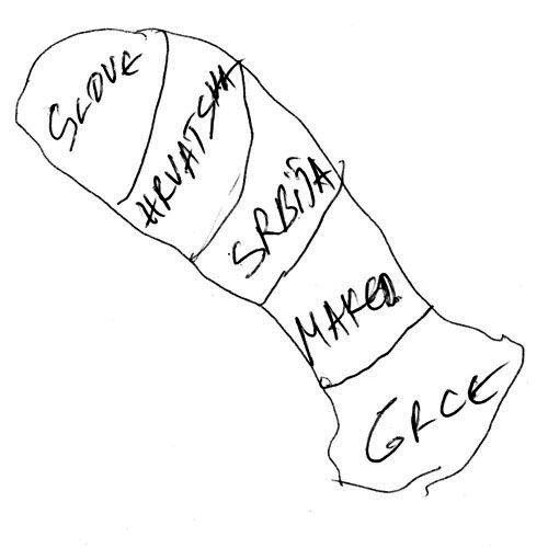
An anonymous map of Macedonia

Thursday, July 28, 2011

On a bus to somewhere else a few weeks ago, I noticed a closed shop with a Macedonian flag in its sign. I made a mental note to return in search of someone from Macedonia.

When I did go back, I found a very small shop selling Macedonian food and whatnot, and a man watching the charts from Macedonia on TV (Kylie Minogue was performing Get Outta My Way - fancy that.)

The man (he didn't tell me his name) did not speak English. Somehow I convinced him to draw a map of Macedonia for me. And then when he folded it up and looked like he was going to keep it, I convinced him to give it to me.

So here it is, showing Makedonia's place in the Balkans.

Macedonia, by a man


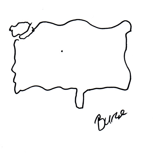
Burce's map of Turkey

Tuesday, July 26, 2011

At the weekend, I went to Turkish Fest which was held near London Bridge.

It was a jolly celebration of all things Turkish, including stalls selling watermelon, kebabs, tourism, as well as a stage with interesting musical acts. As I was there, everyone stood to sing the Turkish national anthem.

I stepped up to the London Turkish Film Festival, where I met Burce. I asked her to draw a map of Turkey.

Turkey, by Burce

Burce, who comes from Ankara, claimed not to be an expert at geography - but I think her map is really quite good.

Miloš' Map of Montenegro

Friday, July 22, 2011

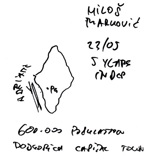
Recently, I met Miloš from Montenegro and he drew me a map.

I was at Café Monte, a cafe-bar in Fulham with a Montenegrin flavour. The food was contintental, the waitress was Romanian, but happily, having had a word with her, she called over her colleague Miloš, who drew this map:

Montenegro, by Miloš

Miloš was very happy to draw his map. He listed off lots of facts and figures about Montenegro, adding these to his map. He was very proud to tell me all about Montenegro's unspoilt nature, its five national parks and how beautiful the country is.

Miloš then surprised me by speaking Irish! He turned out to be a big fan of Ireland, and had run an Irish bar in Podgorica, Montengro's 'capital town', as he calls it on the map.

Irina draws Bulgaria

Wednesday, June 29, 2011

The end of me asking Europeans to 'draw-your-country' is inching ever closer. Only 15 countries remain and, although they're elusive, I'm as keen as ever.

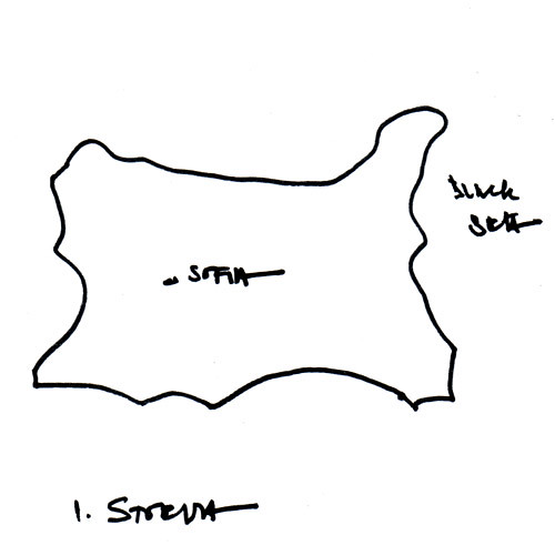
Excitingly, at a party this weekend, I met two Bulgarians, Elena and Irina. I asked Irina, an architect, to draw Bulgaria.

Bulgaria, by Irina


Irina, who has lived in London for thirteen years, thought it could be difficult to draw as the borders had often changed.


By coincidence, she had been having a conversation about maps with a map-maker just before I asked her to draw. This, she said, was probably the first map of Bulgaria she's drawn since school. Amazing!

----

So now, I've 15 countries left to find, and I'm getting a bit more proactive. So if you know someone from any of the these places, let me know: Albania, Andorra, Bosnia-Herzegovina, Cyprus, Czech Republic , Latvia, Luxembourg, Macedonia, Malta, Moldova, Monaco, Montenegro, San Marino, Slovakia, Turkey.

Norway by Isaak, Belarus by Natalia

Friday, May 27, 2011

I've had a map of Norway in my 'drawing Europe's countries' project for a few years. But I'm not quite sure that it's Norway (it could be an upside down Finland...). This is it:

Norway, by anonymous?


So, in Norway, I decided to ask someone to draw another map. Isak - who works in a theatre - drew a map of Norway - very accurately - pointing out Tromso, Kirkenes and Oslo, the place where all the money is.

Norway, drawn by Isak

Recently, out of the blue, through the postcrossing site, I received a postcard from Natalia in Minsk on which she'd drawn a map of Belarus.

This was fantastic. I'm not sure whether I'd ever meet someone from Belarus so I'm very pleased that Natalia sent me her map, which shows Belarus' biggest cities and towns.

Belarus, drawn by Natalia

Hand-drawn maps of Poland by Renata and Romania by Mario

Tuesday, April 20, 2010

I haven't asked people to draw maps for me for quite some time, but my project to re-draw a map of Europe is still definitely going.

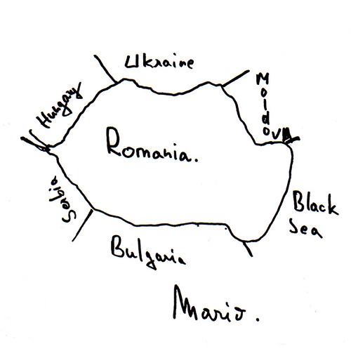
I met Mario from Romania at a party a few weeks ago, and asked him to draw this map. I also told him that his country may win Eurovision this year. He was quite excited about this.

Romania, by Mario

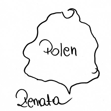
Several months ago, I asked my Austrian boyfriend to ask his Polish cousins to draw a map of Poland - so here's Renata's map of Poland.

Poland, by Renata

I'm now more than half-way through my quest to collect a map for every country in Europe - but I still have great swathes of central and Eastern Europe to find.

EuroGlobe, a map of Europe by Europeans


Map drawings of Ukraine by Yuliya, Switzerland by Lorena & Hungary by Felician and Lisa

Wednesday, May 27, 2009

One of my favourite things about Eurovision parties is the potential to meet others from different countries, especially if that country has an ace song. When Greece won in 2005, I celebrated with a Greek guy at my party and ended up talking to his elderly father (on the phone from Greece) about how brilliant Elena Paparizou had been.

This year, at Eurovision parties, I met people from Ukraine, Hungary and Switzerland, and asked them to draw maps of their countries for my EuroRevision project.

Yuliya, from Ukraine, drew her country. She was bemused by my request.


Ukraine, by Yuliya


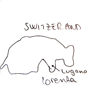
Lorenza, from Switzerland, was in high Eurovision spirits wearing fabulous gloves. She drew this map.

Switzerland, by Lorenza


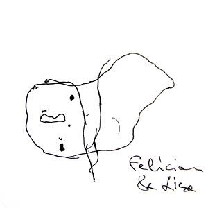
Finally, Felecian & Lisa drew this map of Hungary. Both had been in the UK for three years, initially moving here to find work.


Hungary, by Felecian & Lisa

Draw the world, see the world

Monday, March 30, 2009

I asked Itinerant Londoner Geoff to draw the world (for my MyWorld project) just before he left London to see the world.


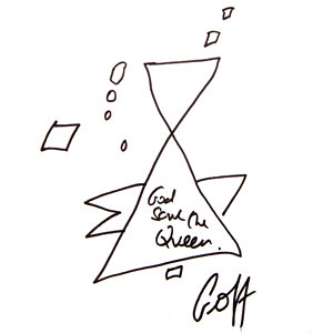
And while the pen and pad was out, Geoff decided to be the UK-candidate for my EuroRevision Project. So here's Geoff's version of the UK.


UK, drawn by Geoff

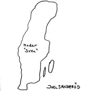
Mama Sweden map, by Joel

Monday, December 08, 2008

I am still continuing to ask European people to draw maps of their country. The latest candidate was Joel, a good friend from Sweden who has since moved back there.

Here's his drawing, emphasising Sweden, his motherland.


Sweden, by  Joel