Things I do
I ask people to draw maps...
· Draw the World
· Draw Europe's nations
· Crowdsourced Continent maps
I make map cards:
· See map cards
Other things I wrote about:
· Little moments from travel
· London art & museums
· Football with foreign fans
· London shop geography
About this blog
I also write a newsletter about museums.
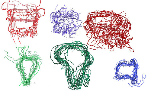
Crowdsourced Continents: The World
Friday, October 30, 2015I went to a Latin American festival, Canada Day and USA Independence Day events, a UK / Australia cricket match, a European folk music festival, an African Craft Fair and a variety of Asian events.
At each, I asked people at the event to draw a map of that event's continent. Some people came from the continent, some from elsewhere.
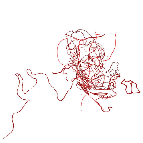
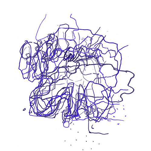
I then took all these maps and laid them on top of each other to create a jumbly mind-memory-map of these continents. And here are all those maps, as the world.
Some were clear - Africa, Australia, South America - and some much less so - Europe and Asia.
In all, we can see that maps are made by drawing, constructs in the moment, made from memory which is patchy and personal, familiar and fascinating.
I've had really interesting conversations with the 87 people who drew these maps, and hopefully, you enjoy them too.
Labels: Africa, Asia, Australia, cartography, Europe, hand-drawn, iaskpeopletodrawmaps, map, maps, multimapped, North America, South America
Europe in USA
Wednesday, July 16, 2014For many years, I've been interested in the way towns, cities, villages and more in the USA are named (I wrote about in 2010).
Reading the article which inspired that blog, I realised that nearly all of Europe was accounted for in American placenames.
So I set about making a map of some European place-names in the USA.
Sadly, there isn't a place for every country in Europe, though sometimes there are more than one, e.g. Norway, Kansas, Norway, Iowa and Norway, Maine, so I chose the place which sat best on the map.
In some cases, a country name is not accounted for, but the capital city is e.g Vienna, Georgia or Sofia, New Mexico.
And occasionally, you really can't be sure that the European placename is the inspiration - e.g. Turkey, North Carolina or San Marino, California
I'm fascinated by the breadth and number of places with names inspired by Europe. I suppose the next step is to start visiting them!
Labels: cartography, Europe, map, placenames, USA
Europe Re-Drawn
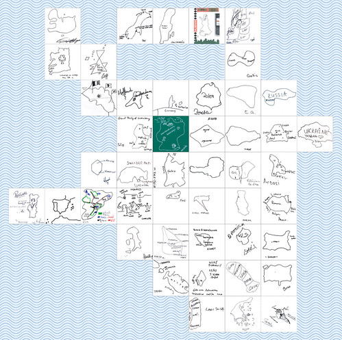
Monday, September 16, 2013About 8 years ago, I started asking people to draw maps of the world. It was a fun project, and over the course of 6 years, I collected the world drawn by 80 people - the world in 80 ways.
During this, I also realised I enjoyed the idea of people drawing their own country - so I set about finding Europeans* to draw their country. And, today, I have finally finished!
The first map I uploaded was on 6 April 2005 - the Netherlands by Rolf. The last - just today, 16 September 2013 - was Bosnia & Herzegovina by Ahmet.
Over the past 8 years, I've collected maps from:
- friends (like Deirdre's Ireland or Hervé's France)
- from friends of friends (like Tatiana's Russia or Yuliya's Ukraine, Lorena's Switzerland and Felician and Lisa's Hungary)
- from strangers I randomly met (like Alice's Belgium or Jaan's Estonia)
- from visiting cultural centres in London (like Miloš' Montenegro or Gaļis' Latvia)
- from the internet (like Daphne's Greece, Mauro's Portugal or Novala's Germany) and
- from visiting lots of countries (like Fredi's Slovenia, Klaus' Croatia and Marina's Serbia or Myriam's San Marino).
You can see the story behind each map here.
And I've enjoyed it all, meeting new people, talking to them and learning more about the huge variety and diversity in Europe.
And now all that's left to be said is a very, very large thank you to all those who took the time to draw me maps.
Labels: cartography, Europe, EuroRevision, hand-drawn, iaskpeopletodrawmaps, map
Sketching Europe & Southeast Asia
Wednesday, July 13, 2011I collected these maps two years ago, but never put them online.
The first was collected at a Thailand festival in Greenwich Park (where I saw the winner of Thailand's Got Talent performing). 15 people drew their maps of Southeast Asia, so thanks to Kris, Rose, Kirsty, Emma-Louise, Hita, Jem and Catherine from the UK, Rose, Yuttakorn, Annie and Chookiat from Thailand, Chris and Denny from New Zealand, Pepper from the Philippines and Alex from Italy.


Sometime later, I went to the New European Village festival at Southbank to ask for maps of Europe. Thanks to the 11 people who drew a map: Joe, Zimbab and Janine from Germany, OQ a 'secret Turk', Sophie and Celine from France, Poppy from Greece, Baz from Belgium, JK from England, Claudia and Luisa from Colombia.


The last few maps have not been as precise as the previous two. Maybe Australia and Latin America are more defined places than Europe and Southeast Asia. Certainly, their shapes are easier to know.
This makes me wonder how to collect the remaining continents. I'm not so worried about Africa, but Asia's more unusual. Do I divide it into regions?
My first thoughts are to have Middle East, India, and China, but it's not an easy division. Where to put Russia, and the big wide middle-ground?
Labels: Asia, cartography, Europe, hand-drawn, iaskpeopletodrawmaps, map, multimapped
New Europe | Old Europe
Friday, July 21, 2006
I was recently led to think about the theme "New Europe". This is understood to mean the proliferation of 'new' states in Central and Eastern Europe - what were once just one country have split and expanded into 2, or 6, or 16.
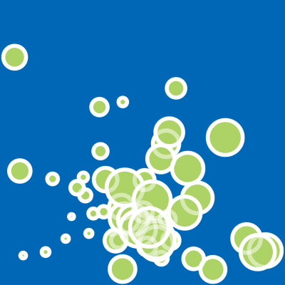
I composed this image based on that idea. Each circle corresponds to a European country. The circles increase in size, following the declared independence of countries. Thus, the smallest is the oldest, the largest is the newest.
San Marino is "Europe's oldest country" as it was founded in the 4th century. Serbia is Europe's newest, officially established in June of this year after Montenegro voted in a referendum to separate from Serbia. Each country is also laid down in order, thus Serbia is to the front, in the lower centre of the picture.
And, below, is the opposite - the countries of Europe, with the oldest as the largest and the newest as the smallest.