Showing posts with label geography. Show all posts

Exploring the 1901 and 1911 census of Ireland

Saturday, January 03, 2026


I recently came across the Irish Surnames Map by Barry Griffin. This website uses census data from the 1901 and 1911 censuses of Ireland and maps them across the island - showing where surnames and forenames are most located. Lots of interesting things to discover!

On that website, I learned there were only 6 people named Adrian living in Ireland in 1901. Not very many, but I suppose the name became more popular in the 20th century. 

Exploring that website led me on to the actual census data websites, run by the National Archives of Ireland. This site includes the 1901 and 1911 census records, and you can search it right down to the individual or household level. I think I found records of my great-great-grandmother and great-grandfather and saw their handwriting (my surname is one of the most common, as were their forenames, so I'm not 100% sure).

You can also search the data by origin. Within Ireland, that means which county they are from. Outside Ireland, it means country. 

Ireland is now a very multinational and multicultural country. There's often some kind of belief that this is all new, but these records show that people from outside Ireland have lived here for more than a century.

I find all manner of interesting records. Here are some highlights.


These are just 10 examples from the thousands, if not millions, of interesting stories found in the 1901 and 1911 census. Anyone can explore these census records online via the National Archives of Ireland.

Ireland's census history is patchy. After 1901 and 1911, the next scheduled census was 1921, but this was cancelled due to war. A census was held in 1926, the first after Irish independence. Now, 100 years later, the records from the 1926 census will be released in April of this year.


Words on Walls

Saturday, November 22, 2014

As a fan of graphic design and typography, I particularly love seeing words painted on walls, signs, billboards and elsewhere.


So much so that I started a Words on Walls Pinterest board to collect my favourites.

To me, typography on walls, signs etc is an equivalent to public art and sculpture. You can get a sense of a city or country through them.


There's something about words painted on brick or metal which strikes me as very American. I took these examples on my trip to New York and Chicago.


Heathrow Hinterland

Friday, December 13, 2013

I went recently on another Royal Geographical Society Discovering Britain walk.

This walk explored what it's like to live in the shadow of Heathrow airport.

Beforehand, I had expected to walk to take me through rather bland, boring mid 20th-century housing estates and lots of them.

Instead the walk went through two historic villages and lots of park and woodland.

Some things stood out...


There was a near constant smell of autumnal smog, like lots of log fires burning.

It was quite confusing and disconcerting. Was I actually smelling domestic woodfires (which, though polluting, have a comforting quality) or is the smell from the constantly soaring planes, the roaring traffic and the area's industry?


The planes are loud, but in some places the constant whirr from M4 motorway traffic is even louder.

The walk took in the previously proposed site of Heathrow's third runway, now a large field. I had rather glibly not paid very much attention to this debate at the time, but being there seeing the site put everything in perspective.

The walk was fascinating, an exploration of an area which I'd never considered before. I'll definitely be looking more closely out of the window the next time I fly from Heathrow.

Iceland is geography

Monday, March 05, 2012

I went to Iceland a month ago, and was agog looking at the landscape. Iceland is a living geography lesson, with amazing landforms all over.

So, a game of spot-the-landform - Geysir hot spring, a hill (don't know its name), Gullfoss waterfall and Faxi waterfall.


Iceland landscapes

And some more - Kerið crater, Strokkur geyser, Hvítá gorge and another hill (don't know its name either)

Iceland landscapes

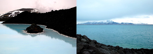
I made my photos black and white because the weather was mainly grey during my visit - except for Sunday, when the sun came out, and colour emerged: blue waters at the Blue Lagoon, and Reykjavik harbour

Iceland landscape in colour


Map pictograms: Georgia

Tuesday, September 07, 2010

It's probably fair to say we don't see many maps of Georgia printed in the UK. So I was intrigued to see these maps in The Economist magazine - advertising Georgia as a business opportunity. Whether you agree with the attempts to westernise Georgia or not, the maps and landscapes are stunning.


Map pictograms: Haiti

Monday, January 25, 2010

I've long thought maps were cool, and I also really love map pictograms - silhouettes or shapes of countries, continents, cities showing their geographical shapes.

It's really interesting that there are some shapes we instantly recognise - the USA, Australia, UK maybe. And there are some we would not - would you know Nepal's shape, Slovenia's, El Salvador's?

So I'm always interested when I see geographical shapes being used in ads, posters or anywhere else.

I recently saw this image of Haiti / Hispaniola, in an advert to build awareness of post-earthquake relief. Many of us would not have known Haiti's shape before this week, but now it has become a symbol and a sign - we see it and instantly think Haiti, and probably think about earthquake, disaster, tragedy soon afterwards.


I see many more of these, so I am going to start posting them from now. For now, though, I'd urge you to visit http://www.dec.org.uk to donate to the Haiti Earthquake Appeal.

Map tattoos: geography on the body

Monday, December 14, 2009

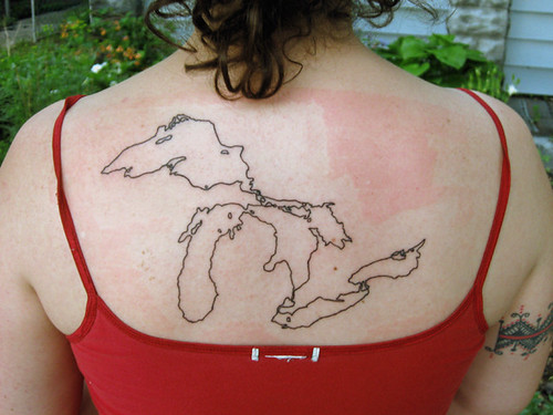
When I was in university, a friend of mine wrote a great geography dissertation about tattoos. She imagined the body as a landscape, with tattoos acting as landmarks and inscriptions in the landscape. People wrote their lives on to their skin, tattoos are like maps to their identities.

Polska

I really liked the idea. I wondered if people would mark their patriotism on their bodies, with maps or national insignia as tattoos.

Tattoo 4


For years, I've wanted to do a photography project on it, but have always stalled at the idea of finding people to photograph. Recently, I started to explore on flickr, finding these fantastic images.

welcome home

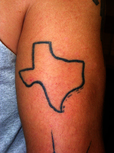
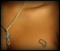
I find it amazing, fascinating and inspiring that people's pride and patriotism lead them to the extent of imprinting maps of their country, state, city onto their skin.

Texas

I've created two galleries of these images on flickr: Tattoo Nation I and Tattoo Nation II

(Thanks to flickr users who have given me permission to show their images.)

Mama Africa

Flag

East from Shooter's Hill: The Urals?

Friday, October 23, 2009

Shooter's Hill in Greenwich is among one of the highest points in London.

Someone once told me that if you go due east from Shooters Hill, the next highest land is the Urals in Russia.

This didn't seen right to me. Shooter's Hill is only 133m high.

So I went to the Royal Geographical Society's library to find out more. We dug out maps of Germany to trace the line of 51 degress, 28' latitude east. (I presumed the Netherlands wouldn't have any higher land).

And I was right - there are a whole host of places in Germany higher than 133m. Forst Gahrenberg and Arenborn, below, are just two.


View Larger Map


View Larger Map


True or False Tour #2

Saturday, April 11, 2009

A colleague who hadn't been on our True or False Tour / Pub Crawl in January asked me to do it again. I jumped at the chance - it was such fun putting it together.

So yesterday, I joined my colleague, and Susanna, Tobias & Caitlin from Sweden to see London, drink in some pubs, and tell lies and tell the truth.

I made a few changes this time around. Instead of having a helper, I was more like a traditional tour guide - except some of my stories were true, and some were false.

This gave me flexibility to make bits up as I was going along, and meant I wasn't talking for a very long time!

I'm happy to report it all went swimmingly well. Caitlin remarked at one point that I should do more of these tours, and I certainly am planning too.

So, in the meantime, if anyone wants a tour around London with fun true-or-false quiz game built in, let me know!

History of my House - Southwark local history library

Sunday, March 15, 2009

I've been digging more into the history of my house. The street does not appear on the 1911 census, so I surmised it either had a different name in 1911 or didn't exist.

Looking at some old maps in the RGS Reading Room brought a little enlightenment - I saw a map from the late 1800s with no street, and one from 1920 with a street. So, it was built sometime at the beginning of the 20th century, making it Edwardian, or (very) late Victorian.

I ordered Godfrey edition maps from 1894 and 1914 which confirmed this (fantastically swift customer service from Alan Godfrey Maps, by the way).

Southwark's local history library - temporarily relocated to Peckham due to renovation - had an index of streets which indicated that street was given its name in 1911. So, the street is 98 years old.

Much more excitingly, in the local history library, I found out the names of all voters who lived in the house from electoral registers.

The earliest I can trace on the street is 1913, but for the first few years my house number is not used (maybe the house was empty? Or maybe the occupants didn't have the right to vote).

And then, from 1918 onwards, these people lived in my house:

  • 1918 - 1929 - Daniel & Clara Ayling
  • 1929-1931 Frederick Jordan, Alice Jordan & Frederick Thomas Jordan
  • 1931-1938 Alice Jordan & Frederick Thomas Jordan
  • 1938-1939 Alice Jordan
  • 1939-1940 Thomas Williams & Ellen Alice Williams
  • 1940-1945 - ?
  • 1945 - 1959 - George & Amelia Fleming
  • 1960-1965 - William & Elizabeth Coulson
  • 1965-1975 - William Coulson
  • 1975-1989 - George & Rosa Knott, with Carole Knott & Christine Knott

Sadly when I got to 2008, I expected to find my name on the register (I was getting very excited about it) but I wasn't there! I had taken myself off the list to reduce junk mail. I may reverse that decision for posterity purposes.

My next stop is the London Metropolitan Archives to find out more about the building of the street - and to see if I can work out why it is Ambergate Street.

History of my House

Sunday, March 08, 2009

I recently read Home: by Julie Myerson (she's been in the news recently for her book about her son's drug abuse - but Home's infinitely more interesting). In it, she traces the history of everyone who lived in her Clapham home.
And it's fascinating. I was engrossed and inspired - I suddenly wanted to find out more about my house.

I live in Kennington in south London, on a street called Ambergate Street. It extends on from one called Alberta Street (by the way - please don't stalk me, thanks).

Given the name Alberta, from Albert, we've always assumed the street was Victorian. I've wondered about the name Ambergate - Ambergate is a village in Derbyshire, could it be named after that?

I do know that prior to there being a street here, there was a zoo - the Royal Surrey Zoological Gardens. Now all that remains is a small park called Surrey Gardens.

So from a zoo to a quiet residential terrace - there's a lot to find out about!

Cabo da Roca - Europe's most westerly point

Wednesday, February 18, 2009

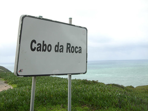
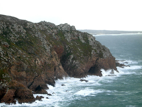
Cabo da Roca is Europe's most westerly point. Well, Cabo da Roca is continental Europe's most westerly point. Europe's most westerly point is in Ireland, Iceland, the Azores or French Guiana - depending on perspective.


Cabo da Roca

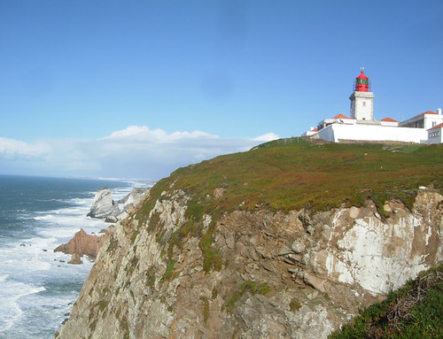
The land to the north of Lisbon, around a town called Sintra, is forested and mountainous. These uplands stretch on to the coast, ending at Cabo da Roca, which is about 140 metres above the ocean.

Getting there is remarkably easy - it's something of a tourist attraction, of course - take a train to either Cascais or Sintra and then bus 403 from there along winding roads through green countryside.


Land, Cabo da Roca, Portugal

There isn't much at Cabo da Roca - a pointless tourist office (I wandered in, they ignored me), a restaurant (empty) and a tourist souvenir shop (nothing but usual stuff). A lighthouse, built in 1772, is closed.


Cabo da Roca

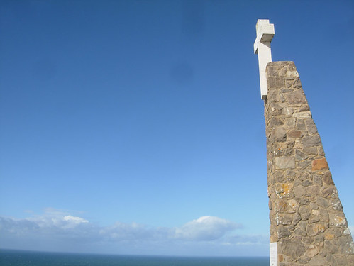
Two monuments can be seen - one (oddly) to the Rotary Club sits a little distance back from the headland, and the other juts proudly into the sky, with a cross and an inscription: Onde a terra termina e o mar começa... / Where the land ends and the sea begins...


Monument, Cabo da Roca


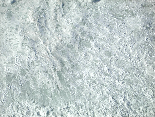
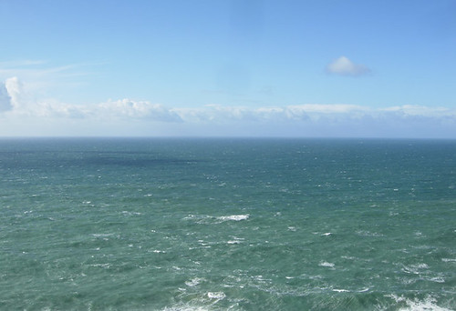
But Cabo da Roca's beauty isn't in buildings. All around you is the world's grand scale and beauty. Looking down the cliff at the crashing waves and spuming foam of the Atlantic, the full brunt of the ocean hits you. It's unrelenting, it never stops - the tide keeps on coming.


Atlantic ocean spray, Cabo da Roca


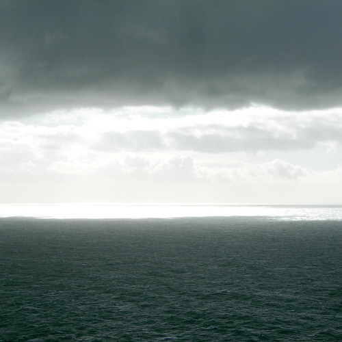
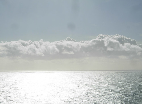
The horizon remains constant, always there, always distant. You could be anywhere, but this is somewhere. My trip benefitted from a sudden change of weather - from drizzly, grey and dull to blue, shining and resplendent.
Cabo da Roca is peaceful despite the fierce ocean, green with sea-gorse and nature's geography at its best.


Ocean, Cabo da Roca


Atlantic Ocean, Cabo da Roca


Atlantic Ocean, Cabo da Roca

True or False Tour & London Historic Pubs Crawl

Thursday, January 08, 2009

It was a colleague's birthday yesterday, and we all went on a pub crawl around some of London's historic pubs.

I had been tasked with devising an activity or game to make the night go with a bang. I thought up a True or False quiz, based on an idea by several bees.

Along the route at each pub, we stopped and heard two stories. I enlisted a helper to tell one story, and I told the other. One of us was telling the trute, and the other making it up.

The game was to guess which was which. If answered correctly, you got a prize.

Our route took us from legal Holborn through carvernous bars to religious Blackfriars:

Along the way we heard stories about telescopes, parrots, queens, bishops, mayors, egg-breaking and lots more interesting things. Some true, some false.

Happily, the audience was divided on every occasion as to what was true and what was false, leading to much spirited debate and laughter.

I thoroughly enjoyed devising this and learning more about history and trivia, and happily my colleague did too, sending me this message at the end of the evening: "Thanks so much for being such winning hosts! It was a great evening, beautifully orchestrated."

On Chesil Beach... there's rubbish

Sunday, November 30, 2008

On Friday, I took the train to Weymouth to visit Dorset's Jurassic coast, Portland Bill and Chesil Beach.


Chesil beach, from above


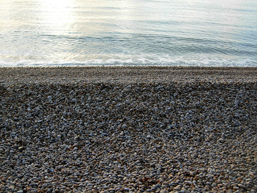
Chesil Beach is an amazing geographical and geological wonder - a huge, 18 mile long bank of pebbles which start out large and become smaller the further you walk along the beach.


Chesil Beach


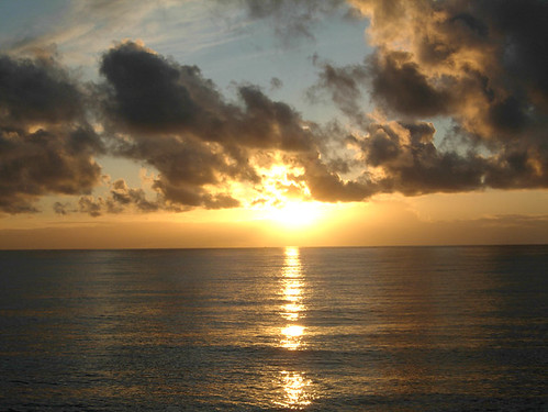
I was very lucky to see a beautiful sunset from the beach.


Sunset, Dorset


The beach has become more popular recently with the publication of Ian McEwan's On Chesil Beach. Signs ask visitors not to take pebbles, but I noticed one family had commemorated their visit by writing on the pebbles.
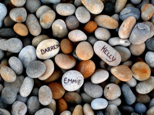

Names written on pebbles, Chesil Beach


I was less heartened to see, however, that rubbish is strewn all over the beach. This ranged from odd shoes, combs, plastic bottles, tin cans and drums to more natural detritus like wood and ropes.


Rubbish on Chesil Beach


It's a shame those signs that say 'don't take pebbles', don't also say 'but please take some rubbish away with you'.


Rubbish on Chesil Beach


That said, however this tin of pimento dulce (sweet paprika) intrigued me - had it floated all the way from Spain or Portugal?

Country name chooser

Tuesday, July 01, 2008

Look to the right, and you'll see a country name picker, a new acediscovery feature. Click the button and a country name is chosen for you.

This will undoubtedly provide hours of fun.

  • Don't know who to support in World Cup 2010 qualifying? Click!

  • Unsure where to go on your next holiday? Click!

  • Playing a 'where in the world' style game and stuck for inspiration? Click!

  • Want to move away and start a new life? Click!
So I'm now supporting Qatar, off to Brazil on holidays (woohoo), have Chad written on a post-it stuck to my head, and will be emigrating to Macedonia.

What did I say? Hours of fun!

Polski-pop

Friday, March 07, 2008

A compilation album of the best Polish music is released next week in the UK - evidence of the growing market for all things Polish in the UK, due to recent arrivals, but hopefully the songs will gather some British fans also.

This is fantastic: part geography, part europop.

The album has a whopping 76 songs, with many Polish Eurovision acts appearing - Edyta Gorniak features multiply, as well as Blue Café, Kasia Kowalska & Justyna.

One song title jumped out at me - Natalia Kukulska's Sexi Flexi. It turns out to be a slice of funky pop, with a simple but ace video. This song is from her tenth album - how many UK popstars achieve such an accolade?


Roads & Rodez

Wednesday, September 12, 2007

Pictures from a wander from Broadgate to Borough

Pictures from a wander on Christian Street

This news story caught my eye last week. Three Norwegian tourists ended up in the small French city of Rodez, having bought a flight which they thought was for Rhodes in Greece.

Sadly the trio (Bente, Marit and Knut - 3 ace Norwegian names) did not stay in Rodez. I would have thought it would be something of an adventure, a journey into the unknown as it were.

Journeying and wandering for their own sake are fun (Norwegians take note!). I love wandering city streets with no particular aim in mind, taking photographs and soaking it all up. The two images here come from two such wanderings: a wander from Broadgate to Bank and a wander along East London's Christian Street.