Filtered train photography.

Wednesday, October 31, 2012

Taking photos on a train can be tricky. First, you need to be fast, then you must avoid the trees and powerlines by the track which could obscure your view. And then the lights in the carriage might reflect on the window.

So instead of trying to avoid these things, I played up to them and used phone filter apps to make the most of them.

Take a look at these photos taken on trains in Germany, Czech Republic, Hungary and Slovakia.


My fave photo apps, by the way, are Cymera and Pixlr-o-matic.

Rarely Seen Hungarian Photographs

Tuesday, October 23, 2012

When I was in Budapest last month, I went to the Hungarian House of Photography which hosted an exhibition of rarely seen photographs by famous Hungarian photographers.

I love Hungarian photography, so it was a real treat to see these photographs.


László Moholy-Nagy, 1927, Roofs in Helsinki / Finland


Laszlo Maholy-Nagy - Parking Lot


Martin Munkácsi - Rain in Sicily, 1929


The photographs in the exhibitions were taken from the many collections in Hungary's regional museums. Most of those I liked came from the Hungarian Museum of Photography (which is in Kecskemét, not Budapest). Their website has lots more photography to explore: http://fotomuzeum.hu/en/photography


Beautiful Budapest

Monday, September 24, 2012

When in Budapest, look up.

Budapest's buildings are beautiful and ugly, a fascinating mixture of all kinds.of architectural styles: gothic, classic, art nouveau, brutalist.

Budapest beautiful
 
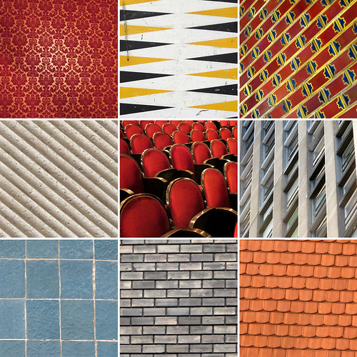
The beautiful buildings radiate, adorned with symbols and alive with detail.

Budapest patterns 

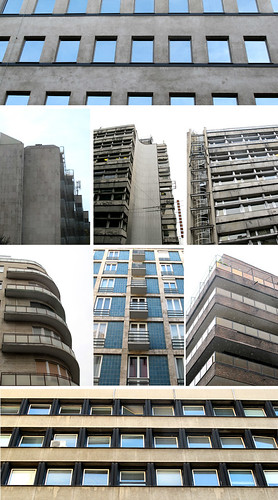
 The uglier buildings are monumentally so, and tell of a dark history.

Budapest communist architecture

I went on a communist tour to discover some of the sights. The guide Andrew mentioned that during the communist times, the city was grey. Buidlings were neglected, allowed to accumulate layers of pollution and urban grime.

Budapest street 

When the 1990s came and the ending of the communist era, the sense of optimism for the future must have been matched by a sense of joy at seeing buildings like these shine again.

What's in Andorra

Monday, August 20, 2012

Andorra is a little landlocked country high in the Pyrenees between France and Spain. I went there, and here's what I saw.

Mountains

Andorra is predominantly made of mountains. If you like mountains, Andorra is the place for you.


Futuristic buildings
The guidebooks are pretty scathing about Andorra's dull buildings. But there are some interesting buildings including the small-Shard-esque spa building.


Shops
Like many microstates, Andorra is a tax-free duty-free shopping haven. I had expected that the town would be empty in the evening as day-trip shoppers went home (like in San Marino).

But there was a buzy atmosphere well in to the evening, which was nice.


Eva's map of Andorra, Charlotte's map of Monaco

Monday, July 09, 2012

In my quest for maps of micronations, I took a trip recently, travelling first to Andorra and onwards to Monaco.


In both places, lovely people working in the tourist offices drew maps for me. I'm nervous of tourist offices, as whenever I've asked their staff  to draw maps, they hand me one of their many printed maps.

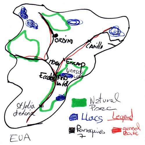
Eva in Andorra was about to do this, but I convinved her that I wanted a hand-drawn map. "OK", she said, and set about producing the most detailed map I've got. It's in four colours and has a legend.

I explained in fledgling Spanish why I was asking for a drawn map. "It's very interesting", said Eva looking proud of her map. And well she should.

Andorra, drawn by Eva

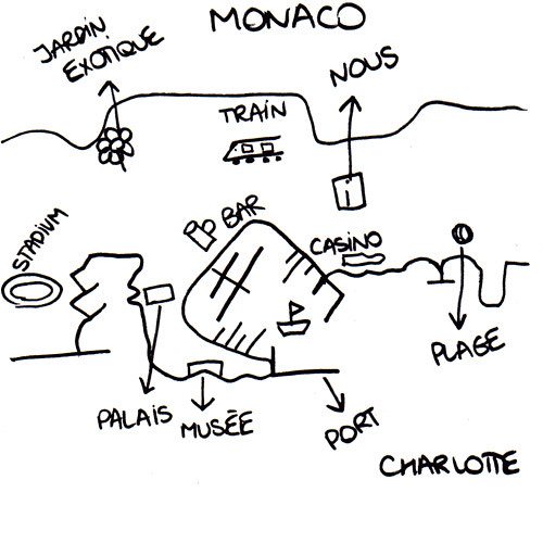
Later in the trip, in Monaco's tourist office, Charlotte drew another wonderfully detailed map of Monaco. At one point, I wondered nervously if she was just drawing Monte Carlo and not Monaco. Then I realised it's pretty much the same thing.

Charlotte seemed pleased with her map too. "We've never had anyone ask us for this before," said her colleague.

Monaco, drawn by Charlotte 

 So these two very detailed maps come from two very small states - and it seems very appropriate for my project to give them as much space as the whole map of larger countries like Russia or Germany.

2,500 days in London

Saturday, May 05, 2012

As of today, 5 May 2012, I've been living in London for 2,500 days. I've blogged a lot about London and taked many pictures of London , and enjoying exploring this vast city.

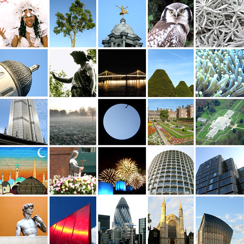
To celebrate, I decided to make a collage of 25 photographs from London - it shows people, art, galleries, museums, nature, graffiti - all the kinds of things that add up to make London great.

25 x London

Myriam's map of San Marino

Wednesday, April 18, 2012

I visited San Marino three years ago.

On my way there, I left my phone on the bus. Myriam, who worked at my hotel very kindly drove me to the bus garage to get my phone back. I spent some time talking to her, she was a very nice person.

During all this, for some reason, I didn't ask her to draw a map of San Marino. Maybe I just forgot, or felt a bit foolish.

I went back to San Marino this week, and found Myriam still working in the hotel.

She remembered me from three years ago, and then drew this wonderfully detailed map of San Marino.

San Marino, drawn by Myriam

Thanks Myriam!


So now my collection of maps of European countries is nearly done - only Andorra, Bosnia, Cyprus, Moldova and Monaco are left. I'm determined to finish the collection this year - here's hoping.

EuroGlobe, a map of Europe by Europeans


Essex Estuary Evaluation

Thursday, April 12, 2012

Last week, I volunteered to test a walk for the Royal Geographical Society's Discovering Britain website.

It is a great website with lots of downloadable guided walks all over the country,

My walk was along the Essex Estuary where the Thames meets the North Sea, and land meets water.


It's only 40 minutes away from London but an interesting walk along a relatively ordinary landscape made even more interesting by the tour commentary.


Iceland is geography

Monday, March 05, 2012

I went to Iceland a month ago, and was agog looking at the landscape. Iceland is a living geography lesson, with amazing landforms all over.

So, a game of spot-the-landform - Geysir hot spring, a hill (don't know its name), Gullfoss waterfall and Faxi waterfall.


Iceland landscapes

And some more - Kerið crater, Strokkur geyser, Hvítá gorge and another hill (don't know its name either)

Iceland landscapes

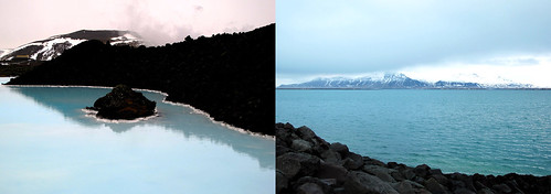
I made my photos black and white because the weather was mainly grey during my visit - except for Sunday, when the sun came out, and colour emerged: blue waters at the Blue Lagoon, and Reykjavik harbour

Iceland landscape in colour


Transbritannia

Wednesday, February 15, 2012

Flights from London to Iceland fly over a lot of water, a little part of Iceland, but mostly over the length of Britain.

Take a look at these aerial photos of mountains, valleys, islands, cities and towns - mine are mainly of Scotland and the north of England, because it was cloudy down south.

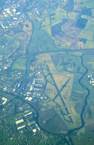
Glasgow airport

Glasgow airport, aerial photo

The Firth of Forth, and Forth Road Bridge

 The iconic Forth (rail) Bridge is just about visible in the background, behind clouds.

Forth Road Bridge, aerial photo

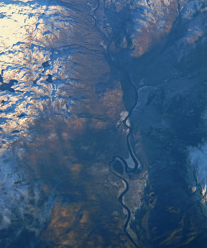
River valley in Scotland

 I haven't been able to identify this one.

Scottish river, aerial photo

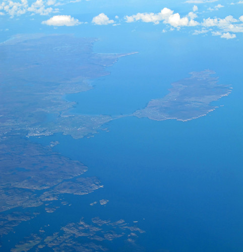
Stornoway and Isle of Lewis

Stornoway is in the left middle-ground.

Stornoway, Lewis, aerial photo

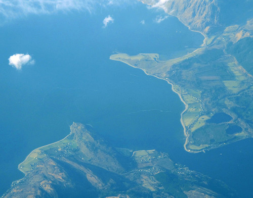
Loch Linnhe

 Two photos of Loch Linnhe - one of the north-western edge, and one where its two sides nearly meet.

Loch Linnhe and mountains, aerial photo

Loch Linnhe, aerial photo

Robin Rigg wind farm

I identified this, as it was the only wind farm with 60 turbines.

Robin Rigg wind farm, aerial photo

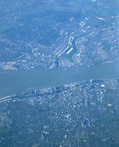
Liverpool, the Mersey and Birkinhead

Liverpool is in the lower half of the photo.

Liverpool, aerial photo