Eyewitness at the Royal Academy

Saturday, July 30, 2011

I went recently to see an exhibition of Hungarian photography at the Royal Academy. The exhibition is called Eyewitness (open until 2nd October), a very appropriate name - it shows how the history of Hungarian photography acts as a witness to many of the most significant best/worst historical moments throughout the 20th century.

Artistic trends such as Bauhaus and abstraction are reflected in the photography, as well as giving a chronicle of how photography developed from amateur photo-players to professional fashion and journalism.

Much of the photography was incredibly angular, shooting at acute and implausible angles. Whereas now we can zoom in and out of the world at the click of a button, then this must have felt revolutionary.

There were lots of photographs to enjoy, here are just some of my favourites.


This photo by Robert Capa shows a French woman who had a baby with a German soldier during World War 2 being led through the streets of Chartres. The photo below - also by Robert Capa - shows  the destruction of Budapest's Elisabeth Bridge.


The photo below - Harvest by Erno Vadas - shows the beginning of abstract patterns and shapes.


Cornell Capa's image of Winchester College shows implausible angles.


To which Lazlo Maholy-Nagy's image from Berlin's TV Tower adds abstract shapes.


Martin Munkácsi's fashion image from Harper's Bazaar


Probably my favourite image: Procession by Erno Vadas


And finally, this book cover by Gyorgy Lorinczy shows how many Hungarian photographs found an excellent subject in the skyscraper and concrete world of New York.

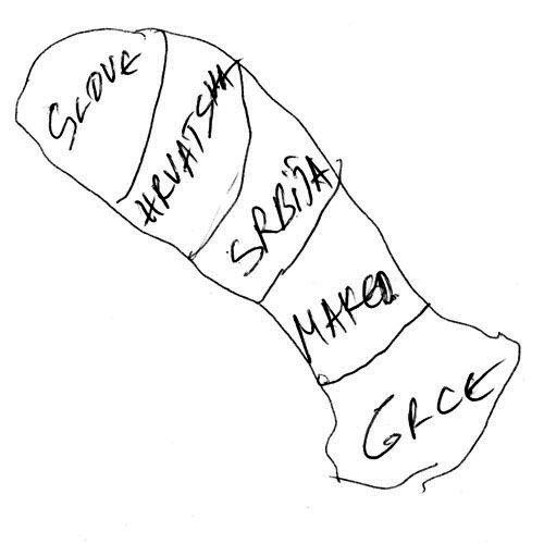


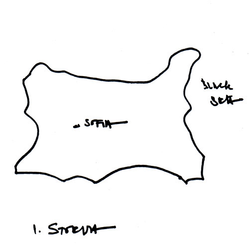
An anonymous map of Macedonia

Thursday, July 28, 2011

On a bus to somewhere else a few weeks ago, I noticed a closed shop with a Macedonian flag in its sign. I made a mental note to return in search of someone from Macedonia.

When I did go back, I found a very small shop selling Macedonian food and whatnot, and a man watching the charts from Macedonia on TV (Kylie Minogue was performing Get Outta My Way - fancy that.)

The man (he didn't tell me his name) did not speak English. Somehow I convinced him to draw a map of Macedonia for me. And then when he folded it up and looked like he was going to keep it, I convinced him to give it to me.

So here it is, showing Makedonia's place in the Balkans.

Macedonia, by a man


Burce's map of Turkey

Tuesday, July 26, 2011

At the weekend, I went to Turkish Fest which was held near London Bridge.

It was a jolly celebration of all things Turkish, including stalls selling watermelon, kebabs, tourism, as well as a stage with interesting musical acts. As I was there, everyone stood to sing the Turkish national anthem.

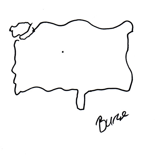
I stepped up to the London Turkish Film Festival, where I met Burce. I asked her to draw a map of Turkey.

Turkey, by Burce

Burce, who comes from Ankara, claimed not to be an expert at geography - but I think her map is really quite good.

Miloš' Map of Montenegro

Friday, July 22, 2011

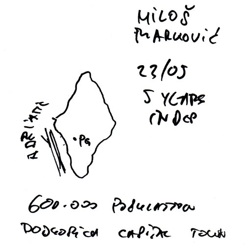
Recently, I met Miloš from Montenegro and he drew me a map.

I was at Café Monte, a cafe-bar in Fulham with a Montenegrin flavour. The food was contintental, the waitress was Romanian, but happily, having had a word with her, she called over her colleague Miloš, who drew this map:

Montenegro, by Miloš

Miloš was very happy to draw his map. He listed off lots of facts and figures about Montenegro, adding these to his map. He was very proud to tell me all about Montenegro's unspoilt nature, its five national parks and how beautiful the country is.

Miloš then surprised me by speaking Irish! He turned out to be a big fan of Ireland, and had run an Irish bar in Podgorica, Montengro's 'capital town', as he calls it on the map.

Sketching Europe & Southeast Asia

Wednesday, July 13, 2011

I collected these maps two years ago, but never put them online.

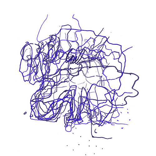
The first was collected at a Thailand festival in Greenwich Park (where I saw the winner of Thailand's Got Talent performing). 15 people drew their maps of Southeast Asia, so thanks to Kris, Rose, Kirsty, Emma-Louise, Hita, Jem and Catherine from the UK, Rose, Yuttakorn, Annie and Chookiat from Thailand, Chris and Denny from New Zealand, Pepper from the Philippines and Alex from Italy.

Sketched Southeast Asia

Photobucket

Sometime later, I went to the New European Village festival at Southbank to ask for maps of Europe. Thanks to the 11 people who drew a map: Joe, Zimbab and Janine from Germany, OQ a 'secret Turk', Sophie and Celine from France, Poppy from Greece, Baz from Belgium, JK from England, Claudia and Luisa from Colombia.

Sketched Europe

Photobucket


The last few maps have not been as precise as the previous two. Maybe Australia and Latin America are more defined places than Europe and Southeast Asia. Certainly, their shapes are easier to know.

This makes me wonder how to collect the remaining continents. I'm not so worried about Africa, but Asia's more unusual. Do I divide it into regions?

My first thoughts are to have Middle East, India, and China, but it's not an easy division. Where to put Russia, and the big wide middle-ground?


Drawing in the City

Saturday, July 09, 2011

I went this weekend to Take A Closer Look, a series of drawing activities arranged by the Big Draw for the City of London Festival.

That's a long sentence to say: drawing fun in the city. It was ace. Combining a bit of wandering around the city, a bit of looking at architecture and buildings, a bit of drawing and a bit of sketching, it was a superb afternoon's entertainment.

Here are some pictures.

A bus on which you could draw things about London. I drew my own version of The Pinnacle, and an elephant and a castle on their London map.


My very abstract Willis Building inspired drawing.


Building a city full of landmarks with cardboard boxes.


I went on a tour with illustrator Jorge Martin where I drew this picture of Lloyds Building.


There was a stall where you could sketch your own new buildings into a city scene. These were then digitally added and coloured by helpful people. Here are three great examples.


Finally, here is my very colourful city scene. I'm hoping the building on the right will get the nickname 'the papoose', but it'll probably be called 'the slug'.


The drawing fun continues tomorrow (Sunday, 10 July). If you can go, do!

Show @ RCA

Wednesday, July 06, 2011

I went to the end-of-year student show at the RCA last week.

I was immediately annoyed by the huge signs everywhere saying I couldn't take a photograph. How are people expected to see the students' work without that?

However, I liked a lot of what I saw, and happily some of it is online (but also some of it is not - what is this, 1992?).

So, big likes to:

Anne-Kathrin Schuhmann's night-time convenience stores (reminded me of these)


Henrik Potter's painted medals.


Wieland Payer's weird fairy tale landscapes


Fay Nicolson's wavy colourful geometrics


Julie Legault's big gemstone metal USB stick necklace


Ashley Rich's parallel lines


Victoria Campbell's slinky shimmery gowns


Darren Donati's monochrome mugs


Joseph Pochodzaj's sloganeering poster project


Yoo Kyung Shin's windswept metallic lamp


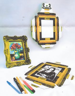
Benjamin Parton's clever use of paper - masking tape to make streetscenes for kids to make cities out of cardboard boxes and other used things like yoghurt lids for satellite dishes. And these doodle-in-the-picture picture frames.


Joseph Pochodzaj


Sketching North America

Monday, July 04, 2011

It's been a while (2 years) since I went collecting continent maps at London festivals. I've decided I want to collect the world, so this weekend I went in search of North America.

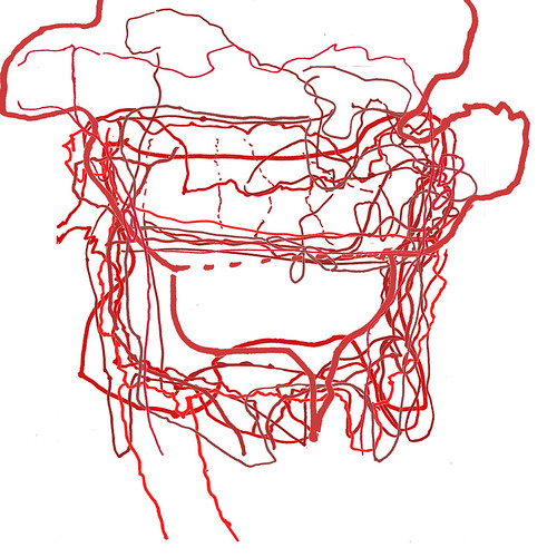
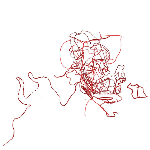
Eleven people drew maps, and here they are all over-laid.

NorthAmerica


On Friday, I went to Trafalgar Square for Canada Day celebrations. There was hockey, mounties, beer and curly fries. It was all very good fun, with people wearing red and maple leaves all over. The 6 people who drew maps for me were fun and friendly.

On Sunday, I searched out 4th of July celebrations. The first event I went to (in Portman Square) was a bit too private, so instead I then went to King Edward Memorial Park where I expected to find a big American picnic.

The turn-out was in fact smaller, but 5 people obliged me. One man had a flag on his hat. Swell!

So, thanks to Alisha, Jen, Jo and Lauren from Canada, Amy, Jessica, Jon and Tim from the USA, Christina and Grem who are English, and Izzy who is English (and Austrian too). Here are their maps individually:

Photobucket

Irina draws Bulgaria

Wednesday, June 29, 2011

The end of me asking Europeans to 'draw-your-country' is inching ever closer. Only 15 countries remain and, although they're elusive, I'm as keen as ever.

Excitingly, at a party this weekend, I met two Bulgarians, Elena and Irina. I asked Irina, an architect, to draw Bulgaria.

Bulgaria, by Irina


Irina, who has lived in London for thirteen years, thought it could be difficult to draw as the borders had often changed.


By coincidence, she had been having a conversation about maps with a map-maker just before I asked her to draw. This, she said, was probably the first map of Bulgaria she's drawn since school. Amazing!

----

So now, I've 15 countries left to find, and I'm getting a bit more proactive. So if you know someone from any of the these places, let me know: Albania, Andorra, Bosnia-Herzegovina, Cyprus, Czech Republic , Latvia, Luxembourg, Macedonia, Malta, Moldova, Monaco, Montenegro, San Marino, Slovakia, Turkey.

A Trip to Tallinn

Tuesday, June 14, 2011

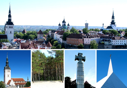
Sights of Tallinn

I recently went to Tallinn, capital of Estonia, for a weekend. This year, Tallinn, along with Turku in Finland, is European Capital of Culture.

So I went there to see lovely medieval streets and cultural what-nots. Here's what I saw...

  • Cute, winding old streets and soaring spires on churches, towers and the city walls.

  • The first thing I saw as I wandered down the street was a display of old maps of Tallinn through time. Amazing!

  • The streets were alive with the sound of music. Singing has a politically and culturally significant in Estonia (they had a singing revolution) so street corners had stages and impromptu choir gatherings.

  • To that end, I also heard Eric Saade's Popular played 7 times in the one night. Now, that's popular.

  • A dank pedestrian tunnel turned into an art gallery.

  • An old lady who was very proud of herself for wearing blue, black and white (the colours of the Estonian flag.)

  • A international parade of nations during a medieval jousting display, with by Koreans, Japanese and Georgians (amongst others) living in Estonia.

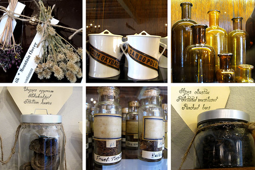
  • My favourite sight was the town's old pharmacy, which is the world's oldest continuously-running pharmacy. Displays showed lotions and potions from the past few centuries, including sun-bleached dog faeces, parched bees and dried toads.
Old pharmacy, Tallinn

One to One Hundred

Wednesday, June 08, 2011

There's a group on flickr called The Design Disease. I'm a member. The name's not the most pleasant, but it refers to how design runs through your veins.

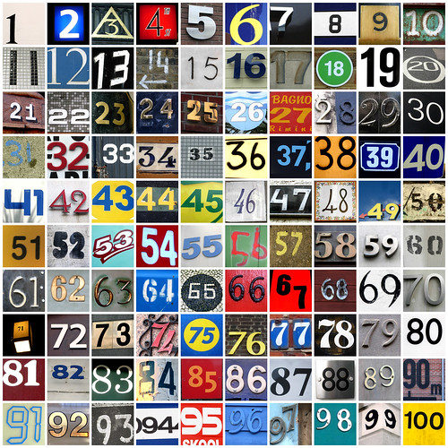
On the group founder's blog, he gives an idea about taking photos of numbers from 1 to 100. That was enough to give me an idea, so I set about finding numbers.

It's taken about 4 years, off and on, but here we are.

1 to 100


Norway by Isaak, Belarus by Natalia

Friday, May 27, 2011

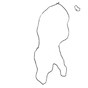
I've had a map of Norway in my 'drawing Europe's countries' project for a few years. But I'm not quite sure that it's Norway (it could be an upside down Finland...). This is it:

Norway, by anonymous?


So, in Norway, I decided to ask someone to draw another map. Isak - who works in a theatre - drew a map of Norway - very accurately - pointing out Tromso, Kirkenes and Oslo, the place where all the money is.

Norway, drawn by Isak

Recently, out of the blue, through the postcrossing site, I received a postcard from Natalia in Minsk on which she'd drawn a map of Belarus.

This was fantastic. I'm not sure whether I'd ever meet someone from Belarus so I'm very pleased that Natalia sent me her map, which shows Belarus' biggest cities and towns.

Belarus, drawn by Natalia

Experimental travel

Tuesday, May 17, 2011


I've had The Lonely Planet Guide to Experimental Travel on my bookshelf for about 7 years. It's one of those books you read with lots of things to do, but that you never actually get around to doing.

Well, no more. I took it from the shelf, perused it and found the following ideas which I'm going to  try out in London.

A-Z TRAVEL


  • Choose a town to visit from A to Z. Find the first road beginning with A and the last beginning with Z, and draw a line between the two. Walk the length of this line and discover the city alphabetically.

ALTERNATING TRAVEL


  • Leave your home. Take the first road on the right, then the next on the left, then the next on the right, then the next on the left, etc. Carry on until something blocks your path and you can't carry on.

CHANCE TRAVEL


  • Insert the name of your home town into the index of a world atlas (if it's not there already). Throw a dice then count that number of lines down from your town. The one your finger lands on is the destination of your trip.
  • So for example if you live in Melbourne, Australia:
    • One will take you to Melbourne, USA
    • Two will take you to Mele, Cap, Italy
    • Three will take you to Melekess, Russian Federation
    • Four will take you to Melenki, Russian Federation
    • Five will take you to Mélèzes, Rivière aux, Canada
    • Six will take you to Melfi, Chad

END OF THE LINE TRAVEL


  • Take a bus, tube or train out of a city and travel until the end of the line. Find accommodation to stay the night and explore the suburb that you find yourself in.

EXPEDITON TO K2


  • Explore the area on a town plan or map that sits in the square marked K2. Take full advantage of all cultural attractions, gastronomic delights and watering holes in that area.

BARMAN'S KNOCK


  • Go to your favourite pub and order your favourite drink. Ask the barperson where their favourite pub is and what they drink there. Go there and order their recommended drink, and then repeat the exercise with whoever serves you, and so on. 

SYNCHRONISED TRAVEL


  • Travel a synchronised path with your friends and discover whether parallel lines ever meet.
  • Participants travel around a chosen location using a 10-stage set of common directions, taking notes and photographs to record their experiences at each stage. Where directions don't match the environs, improvise.
  • The first stage is your starting point.
  • Walk in any direction for 50 to 100 paces, and then turn 180 degrees.
  • Continue walking in that direction until you see something blue.
  • Make a left turn and walk 50 to 70 paces.
  • Walk in any direction until you see something that either is or looks like the number 7 or 11.
  • Take the first left, and continue walking until you find somewhere to sit.
  • Choose any direction and walk for 25 to 50 paces.
  • Continue walking until you see an unusual colour, shape or texture. Turn 180 degrees.
  • Keep walking in any direction until you see an archway or an unusual architectural feature.
  • Head for home, but continue looking for something that catches your eye. 


TAKING A LINE FOR A WALK

  • Create an itinerary by drawing on a map.
  • Using a pencil or GPS, super-impose a drawing on a map, which will then form your itinerary.

There are lots more ideas on the Lonely Planet's Experimental Travel page.

In fact, the book was so good, I was inspired to make my own experiment:


ALPHABET SOUP


  • Each person writes a letter on a sheet. These are organised to create name of place (or nearest place in index). Go there.


So, I'm going to try out some of these in London (and maybe elsewhere!). I'll let you know how I get on.

Nordkapp - Europe's most northern point

Tuesday, May 10, 2011

I've just spent a week or so in Norway. I had decided to go all the way to the top, to Nordkapp. That's considered to be Norway's most northerly point and also Europe's northernmost point (sort of... everyone seems to just plain ignore the fact that there are other headlands further north).

Sadly, I didn't quite make it. I got 34 kms away, a small village called Honningsvåg. The road further north was closed because of strong winds. So I went as far north as possible.

I took great comfort in an exhibit in the town's museum which noted that, in 1905, Queen Maud of Norway didn't make it either. Bad weather also stopped her journey northwards.

So instead of photographs of the real thing, here are a few arty views from the Nordkapp Museum.


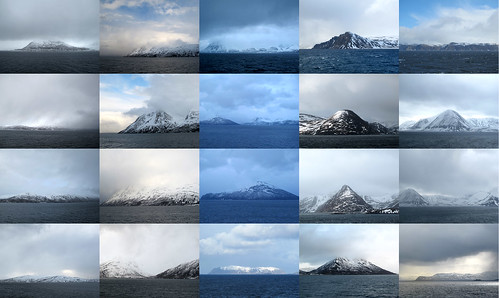
The real Nordkapp may have looked like these - lots of icy, snowy mountains in the north of Norway, taken during my two 17-hour  trips on the Norwegian ferry Hurtigruten.

Northern Norway mountains

By happy coincidence, in February, when I travelled from Gibraltar to Seville, I passed through Tarifa, mainland Europe's most southern point. It's fair to say, it was warmer.

I've also been to mainland Europe's most westerly point, but the most eastern may elude me (because there is no exact location), but I'll console myself with the staggering fact that Honningsvåg is further east than Athens, Belgrade, Riga and Tallinn. Wow.

Name the Olympic neighbourhoods

Tuesday, April 12, 2011

London 2012 Olympic stadium from above

I like placenames, and I particularly like knowing why somewhere is named how it is named. I like that Argentina is named after silver, that Pakistan is an acronym and that Elephant & Castle has lots of stories to its name.

So I was excited to discover that the London 2012 Olympic Park Legacy Company have launched a competition to name the five Olympic neighbourhoods which remain once the games have ended.

They are inviting the public to suggesting names for the five new neighbourhoods in Tower Hamlets, Hackey and Newham. You can enter until May 18.

My suggestions were:
  • Neighbourhood 1: Previously, this are was used for potting sheds; during the Olympics this will be the site of the basketball arena. I went for Hoopshed.

  • Neighbourhood 2: Previously, White Post Lane ran through here; during the Olympics it will be the Media and Broadcast Centre. I chose Broadpost.

  • Neighbourhood 3: Previously, this area housed confectionery factories and timber yards. After the Olympics, it'll have lots of leisure facilities. I decided on Sweetwood.

  • Neighbourhood 4: This is the site of the Olympic arenas. And as Temple signifies the site of a temple, and Bank is where the banks are, I thought Arena should be where the arenas were.

  • Neighbourhood 5: An area which will be mainly residential, bordered and crossed by canals and the Bow Back River, I chose Bow Waters as the name.

What do you think? Are you entering? What are your suggestions?

About notebooks

Thursday, March 24, 2011

About 18 months ago, I realised that I was recycling a lot of envelopes.  I was about to start working at Waste Watch, a charity that encourage people to think about their waste. Most of those envelopes I was recycling were blank bits of paper.

It was good, of course, that they were being recycled, but they actually could be used again.

So I decided to keep them, and convinced colleagues to keep their envelopes. When I gathered them all together, I bound them into notepads. So I got busy with a letter opener, slicing every envelope apart.

At that time, Borders bookshop was going out of business. They had ridiculously low liquidation sales, with maps of all types selling for very little money.  Thinking "I'll find a use for them!", I bought some (well, lots actually).

Those two ideas came together: the maps could be nifty covers for my envelope notebooks.

And since then, I've gone through a series of different versions (proper designers might use the terms 'iterations' or 'prototypes').

The first type was very basic, still showing the ragged, cut edges from the letter opener.


So I brought the notebooks to a printing company, who nicely trimmed the edges. Lovely.


Later, having given some to friends and colleagues, I realised that a different type of binding would be better. So I brought some new notebooks to a binder, and had them ring bound. And they're lovely.


And so now, my staple-bound map notebooks are on sale on folksy, and I have a decision to make.

I'd like to keep this idea alive, but I don't really want to spend hours and hours making these notebooks. A lot of the stationery that sells online are luxury, high-end, artisan notebooks, but, to me, these notebooks are just notebooks. They're to be used and not treasured.

So I'm looking for ideas, inspiration, a partner, a way forward. Your suggestions are welcome.